I go to Los Angles for work every few months, but I rarely get to see any of it. This trip, I got to sneak off for the afternoon with my brother and sister-in-law (who live there) for some touristy fun. I don’t like the typical tourist activities and wanted to do something a little off the beaten path, so to speak. When I found out that you can (legally) hike up to the Hollywood Sign I knew I had to do it.

The Hollywood Sign originally read “Hollywoodland” and was erected in 1923 to advertise a new housing development in the Hollywood hills. It was only intended to last a year and a half, but has become one of the most recognizable images in the world.

There are several paths up to the sign, but I decided on Hollyridge Trail because the end of your hike actually takes you behind the sign! It is a 3.5 mile round-trip mike that ascends about 750 feet to the top of Mt. Lee. However, if you are visiting on a weekend or holiday you cannot park anywhere near the trailhead. The trail begins at the end of Beachwood Dr., which is residential parking only. (Plug 3400 N. Beachwood Drive into your GPS to get there). We ended up parking 1.3 miles from the trail, making our journey to the top and back over 6 miles. The extra walking was worth it. Beachwood is a beautiful street with unique homes and fragrant fauna. The shaded walk smelled of honeysuckle and lemon trees. Be sure to hit up Beachwood Cafe at the beginning of your hike for a snack and the worlds greatest basil mint lemonade.

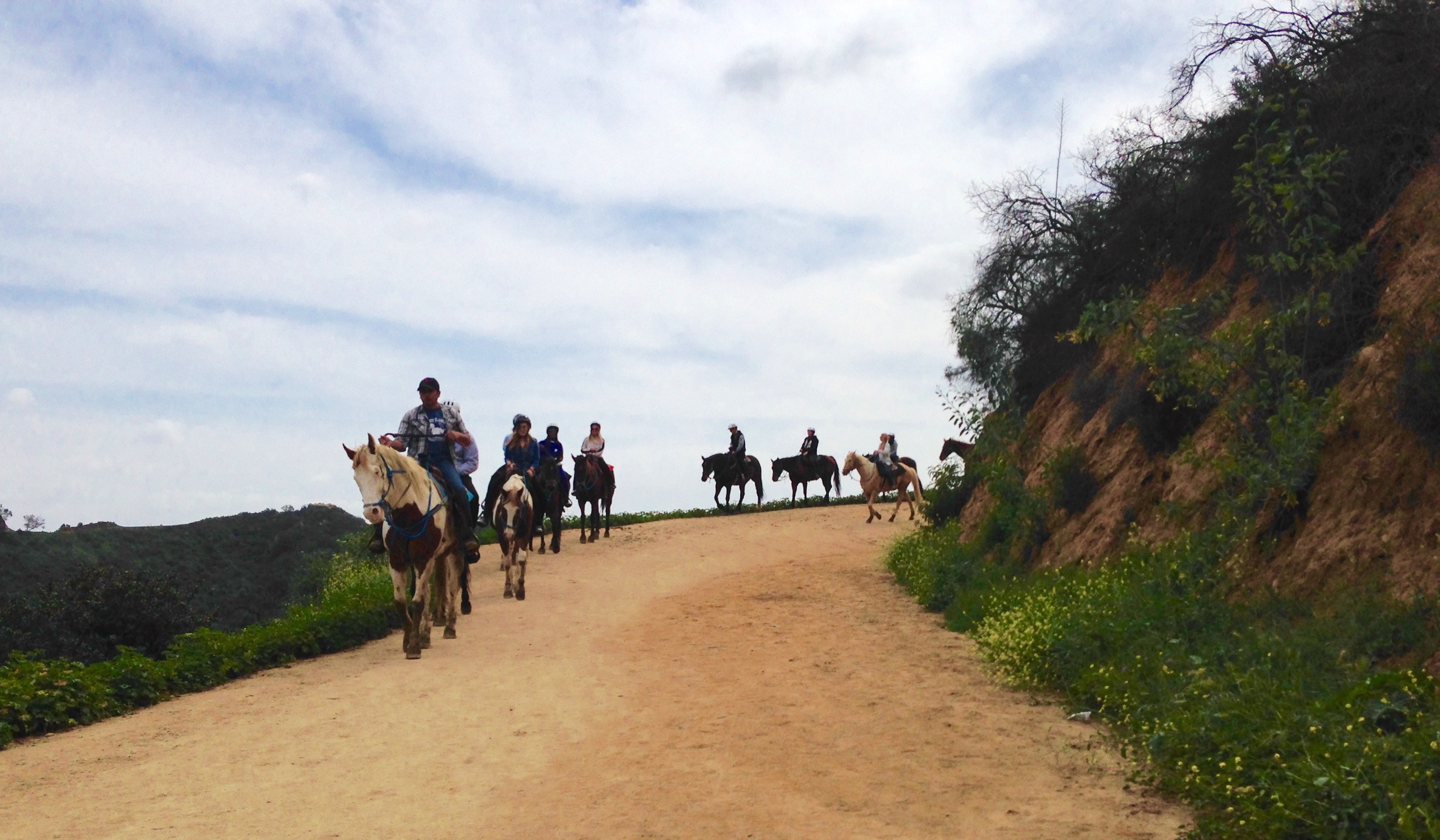
The trails are either dirt or paved road. There isn’t a lot of hiking involved, but it is almost all steep hills. However, the dirt paths are also horse paths so they smell a bit . . . manurey.
A few minutes into the Hollywood Trail hike the path splits and intersects with Mulholland Trail. This is, of course, completely unmarked. We walked right past the turn off and continued straight for several minutes. So, if you visit, be sure to take a sharp left when you come upon the junction. (We should have followed these directions).

But the detour wasn’t all bad. The views were incredible and the foliage was extra green from recent rains.
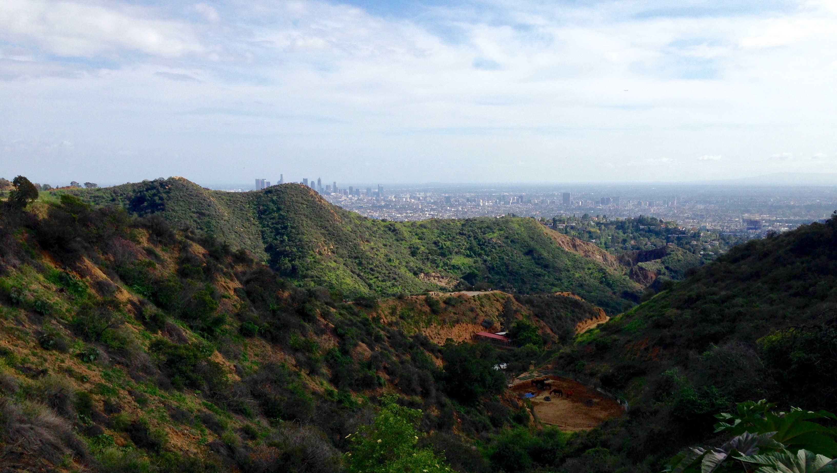
Every once in a while the city of Los Angles would peak out from behind the hills and remind us that it was there. The trail was serene compared to the bustling city below.
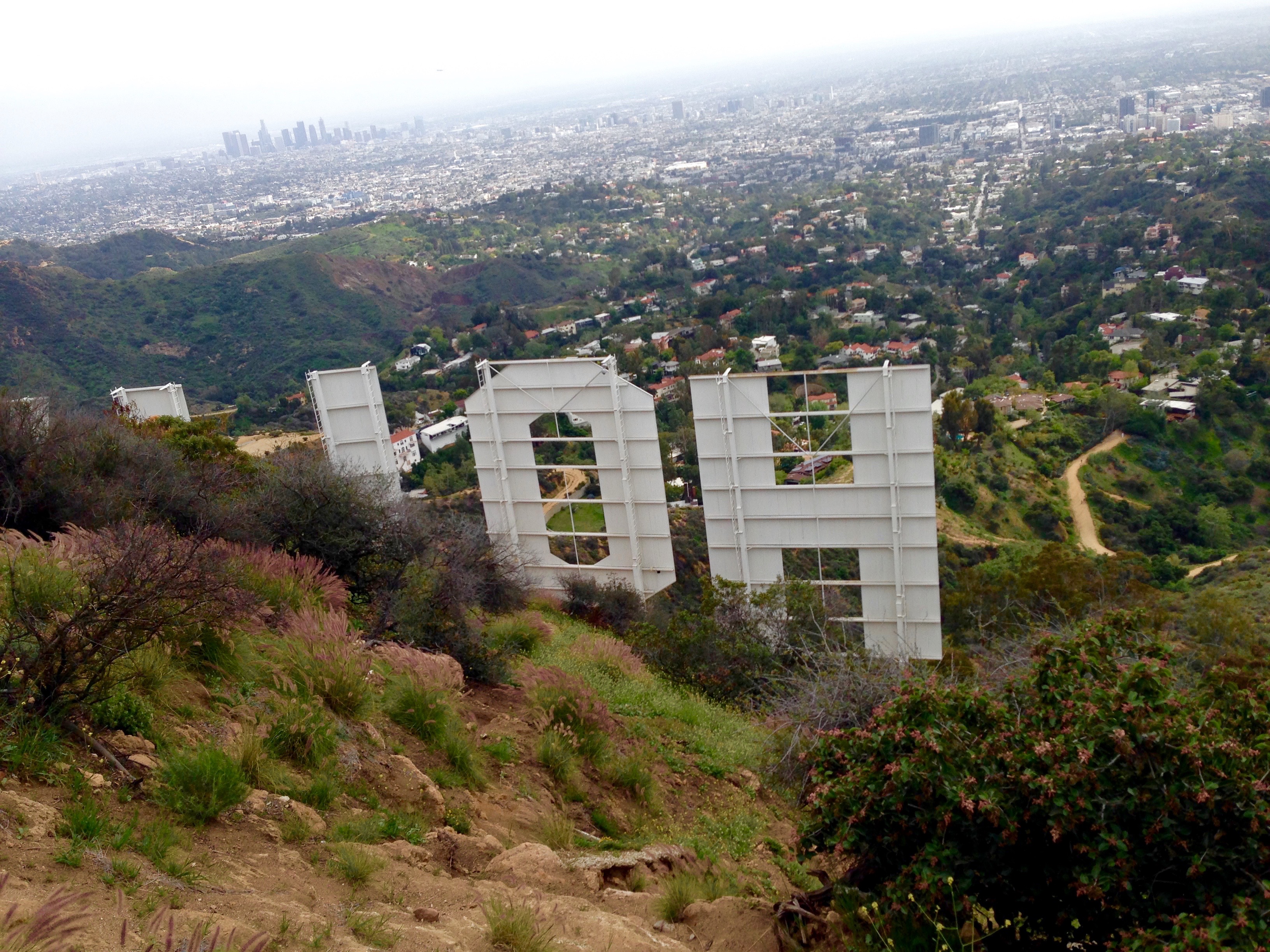
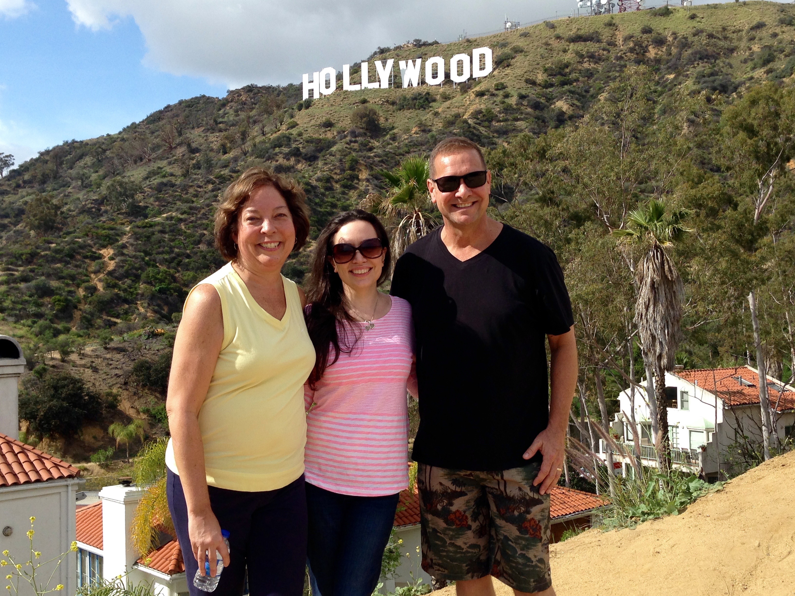
As you reach the peak of Mt. Lee the legendary sign comes into view. The 45-foot-tall letters tower over the city below.
Although it was a bit overcast (for LA) you could still see for miles. Downtown LA is off to the left and the Pacific Ocean is off to the right. (You can click on the images to enlarge them). At a peak of 1700 feet, the view of Los Angeles was incredible. However, it was also incredibly windy and cold.

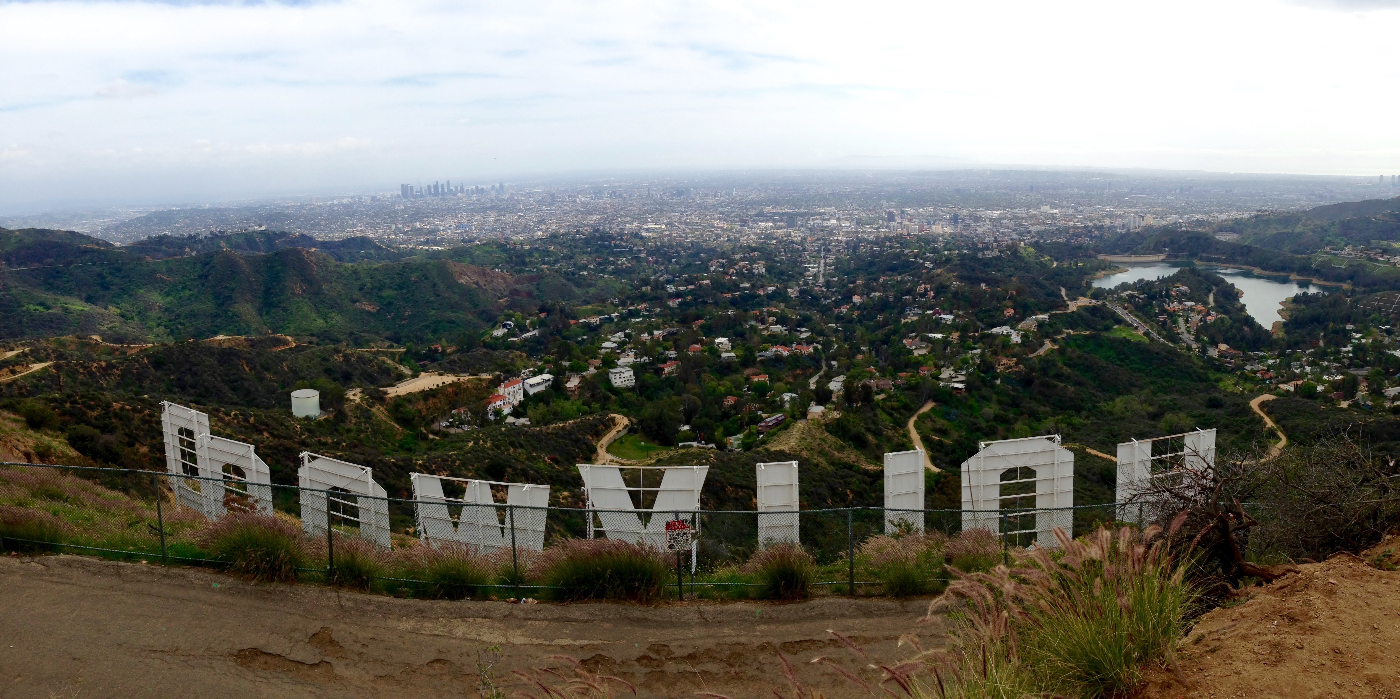
After we finished our picture taking we headed back down the hill to loop around to see what we were told was “the best view of the sign in the city.” The same trail that takes you to the peak also swings back down around in front of the sign. It was, of course, yet another incredible view.
The whole trip took us about 3 hours, and it was well worth the time. I would happily do it again just to get another chance to see the view. It was a great way to do something touristy without dealing with the crowds and traffic. Above all else, it was perfect for some quality family time.
PS: Shout out to my buddy Brad for inspiring the hike, even if he is pissed at me for not telling him I was in LA.

That sounds so fun!!!
LikeLike